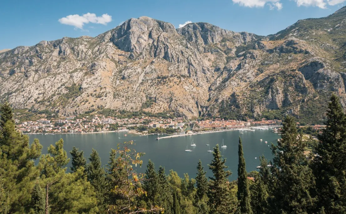
Kotor has no shortage of hikes. The Kotor Fortress trail is the obvious one, the Ladder of Kotor is the one everyone’s talking about, and both are great. But if you want something quieter, wilder and honestly more rewarding, Fort Vrmac is the one most visitors never find.
The trail starts in Muo, a small village on the western side of Kotor Bay, and follows the Franz Joseph path up through pine forest and open karst to the old Austro-Hungarian fort sitting on the ridge above. From there, if you have the legs for it, the ridge continues all the way to Donja Lastva on the Tivat side of the peninsula, passing the highest point on the Vrmac range and dropping through a medieval stone village before reaching the coast. That full route is over 17 km one way and takes around 7.5 hours, though most people do a shorter version: Kotor to Fort Vrmac.
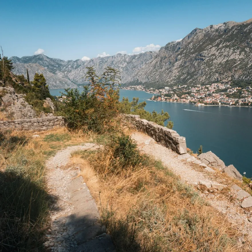
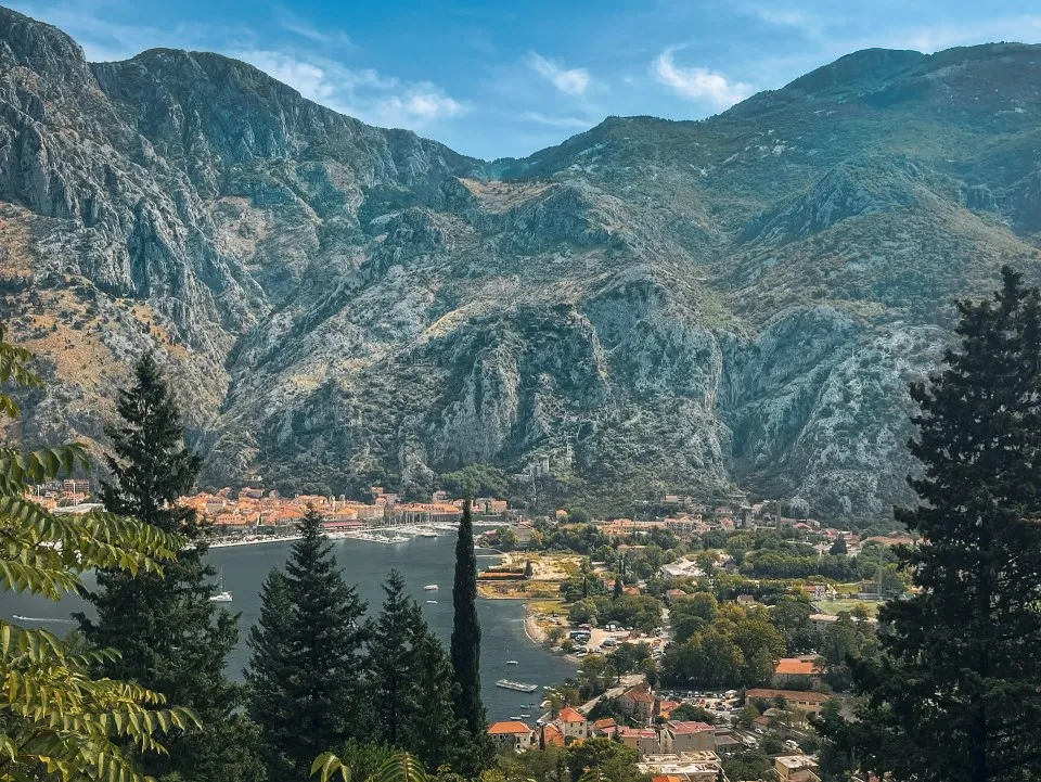
Along the way you get views of both Kotor Bay and Tivat Bay simultaneously, turtles slowly making their way along the path, a working farm where you can buy fresh cheese and eggs halfway up a mountain, and a genuinely eerie abandoned fort that has to be seen to be believed. This is Kotor’s hinterland and it is well worth the effort.
RELATED: read my Kotor travel guide here for all the essential info to help plan your trip →
Some links in this post are affiliate links, meaning I may earn a commission at no extra cost to you if you make a purchase.
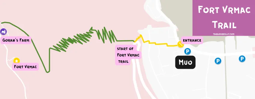
Fort Vrmac Map
Why Hike Fort Vrmac
Most people visiting Kotor never make it to Fort Vrmac. They do the Kotor Fortress, maybe the Ladder of Kotor, and they leave thinking they have covered the hiking. They have not.
Fort Vrmac is quieter, wilder and in a lot of ways more interesting than either of those trails. The path up is called the Franz Joseph trail, named after the Austro-Hungarian emperor who apparently loved the views so much he put his name on the route. The fort itself is genuinely fascinating, a crumbling 19th century military ruin sitting on top of a limestone ridge with bats in the rafters, frescoes barely visible on the walls, and a room full of women’s shoes that nobody can explain.
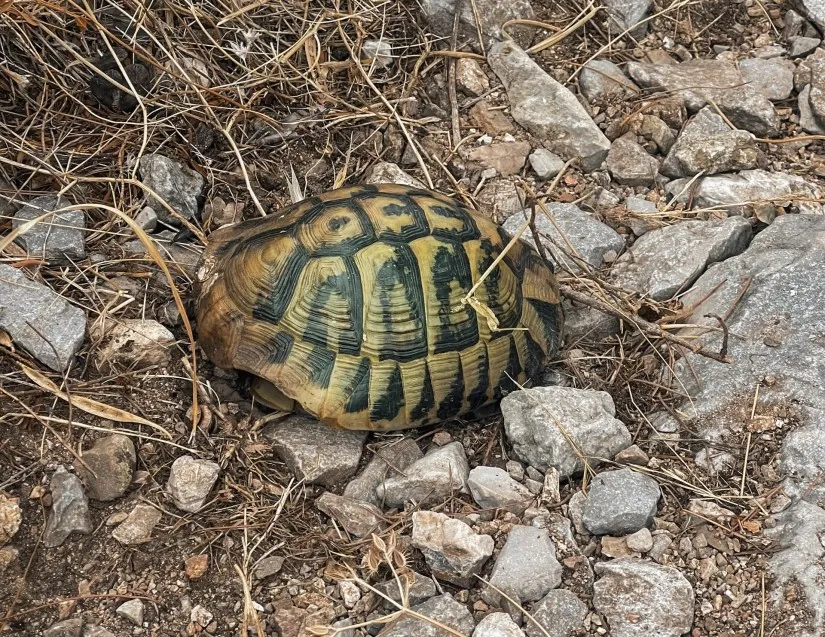
On the way up you will share the path with Hermann’s tortoises going about their very slow business. Halfway up there is a working farm run by a man called Goran where you can buy fresh eggs and cheese and, if you feel like it, camp for free. The views from the switchbacks take in the full sweep of Kotor Bay. And if you keep going past the fort, the ridge opens up and you get both bays at once, Kotor on one side, Tivat on the other.
We did this hike four times. The paid fortress trail once. That is really all you need to know.
![]() Spending the night? I’ve put together a guide on where to stay in Kotor, including the best neighborhoods and hotels for all budgets.
Spending the night? I’ve put together a guide on where to stay in Kotor, including the best neighborhoods and hotels for all budgets.
How To Hike Fort Vrmac
Fort Vrmac – Important Info
| Distance | 7.4 km return trip |
| Elevation | 440 m |
| Difficulty | Moderate |
| Time | 3–3.5 hours out and back |
| Crowds | Very quiet |
You can find the AllTrails route here.
Difficulty
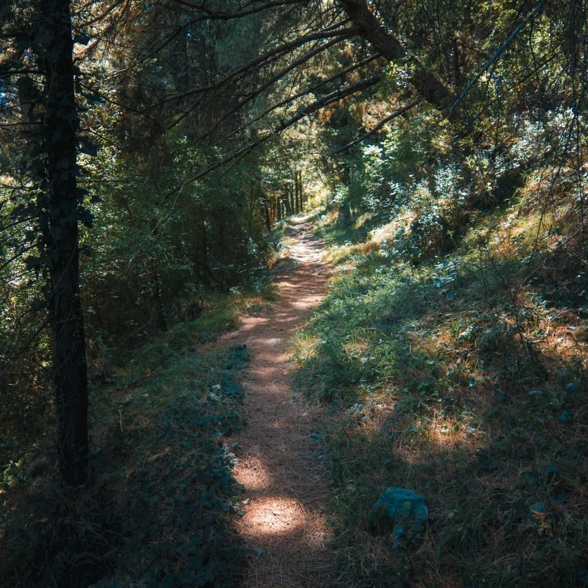
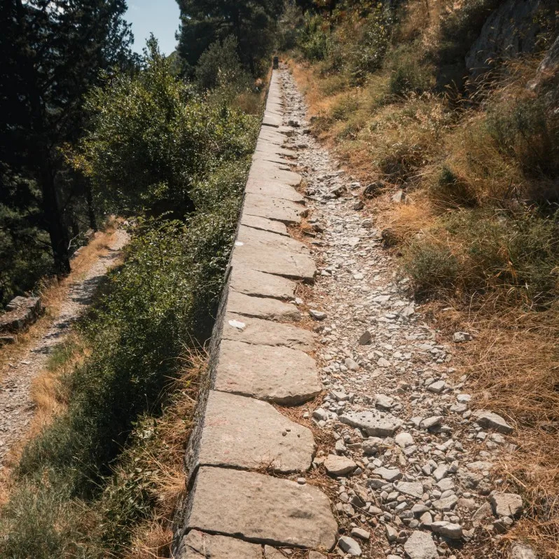
Fort Vrmac is a moderate hike with over 30 deceptively steep switchbacks. The trail is a narrow rocky path, there is only enough width for one person to walk comfortably.
The ascent is relentless, not extremely steep just a long slog of uphill switchbacks. No technical skill is required here, you don’t have to scramble up any cliff edge.
Best Time To Hike Fort Vrmac
The Fort Vrmac trail faces south and west, once the sun climbs it hits you directly but in some points trees offer a little shade. The best time to hike Fort Vrmac is early morning to avoid the strong sun. I suggest starting between 7 and 8:30 AM.
Starting Point
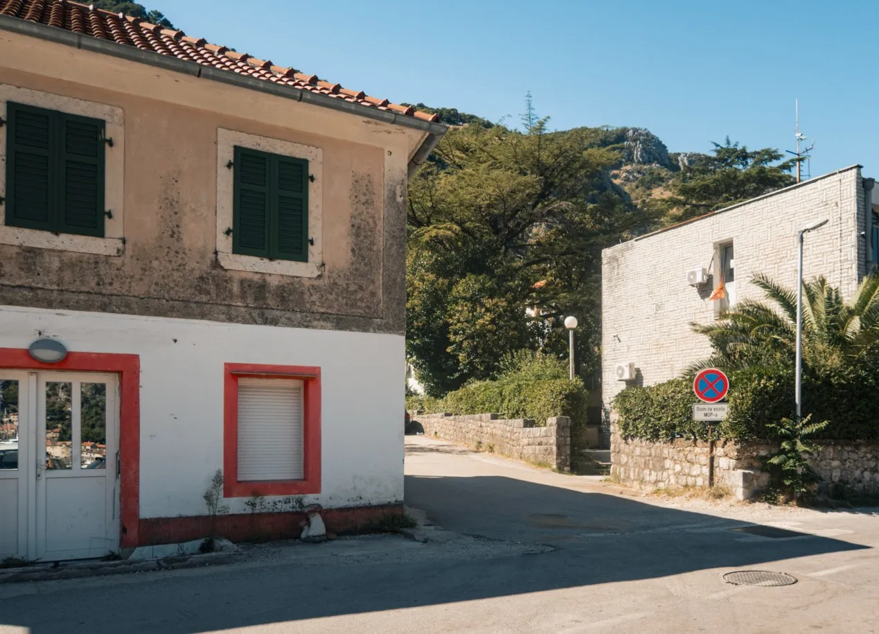
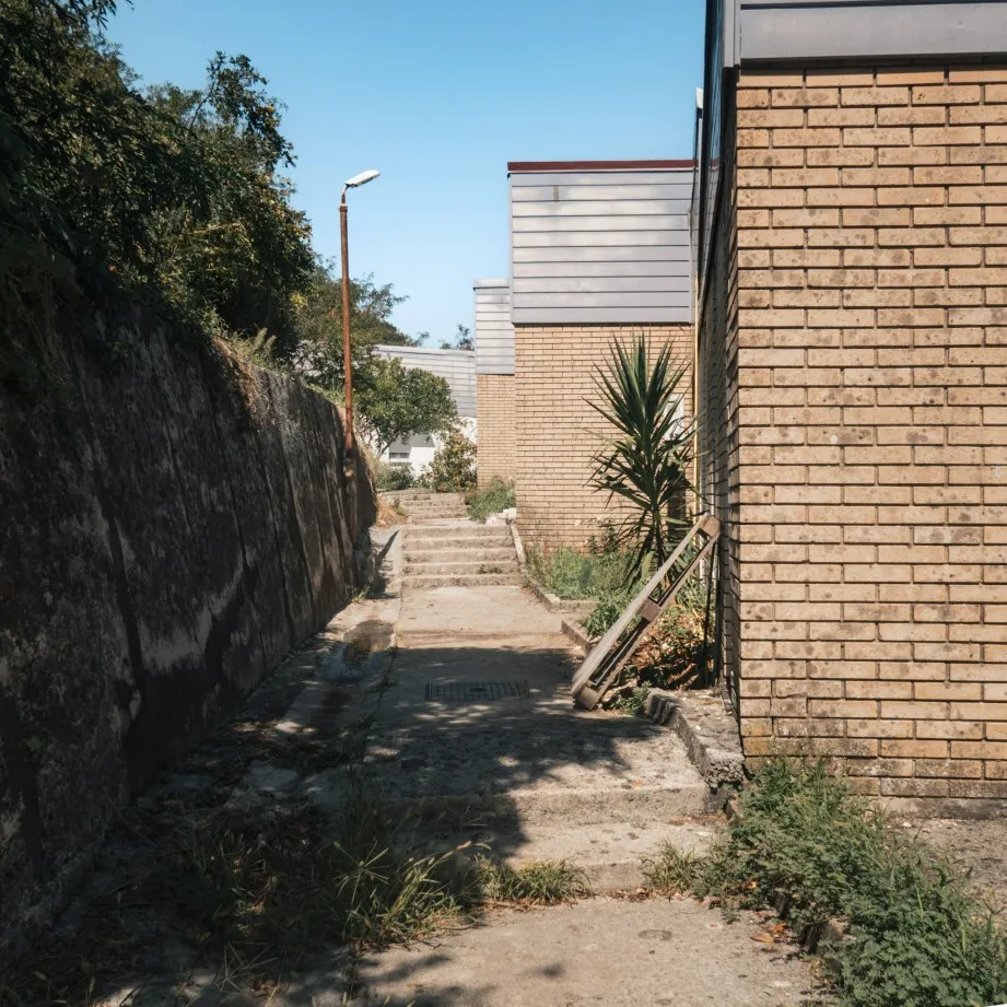
The starting point of Fort Vrmac is above the small village of Muo, 2.4 km west of Kotor Old Town (36 minutes walk). There is an easy shortcut you can take to get to the Fort Vrmac trail a lot quicker.
It’s not clear on Google Maps, but you can instead walk 1 km from the old town to Muo and walk 400 metres up a long series of concrete staircases to the trailhead. It is steep but it cuts about 10-15 minutes off. I have marked out the route on the Map.
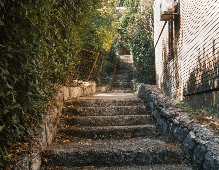
Eventually you’ll arrive at a small alley with lots of houses (and cats), turn right and follow the stairs again until you reach a main road (P22). Turn right down a grassed path, it looks abandoned but it’s not, you’ll walk by a house and then shortly the path will open up into a forested area.
Where To Park
Kotor is notoriously hard to find parking, there aren’t many places and where there is, the spaces fill up fast.
- The closest car park to the Fort Vrmac trail is located here, beside the shortcut entrance I explained above. This is a free car park, but has no security.
- A larger parking lot is beside the city park called Parking Puc, it’s about 3 minute walk from the shortcut entrance, it costs about €1.50 per hour and has security. GoogleMap location.
- Another secure parking lot is Parking Autoboka, located a few metres up from Parking Puc.
The Route: What To Expect On The Way Up
Contrary to what the convoluted entrance trail suggests, the main trail is simple to follow. The total trail is 7.74 km out and back taking 3-3.5 hours.
This is a much quieter trail than the Kotor Fortress and Kotor Ladder trail, we climbed in August and early September, only met 2-4 people each time.
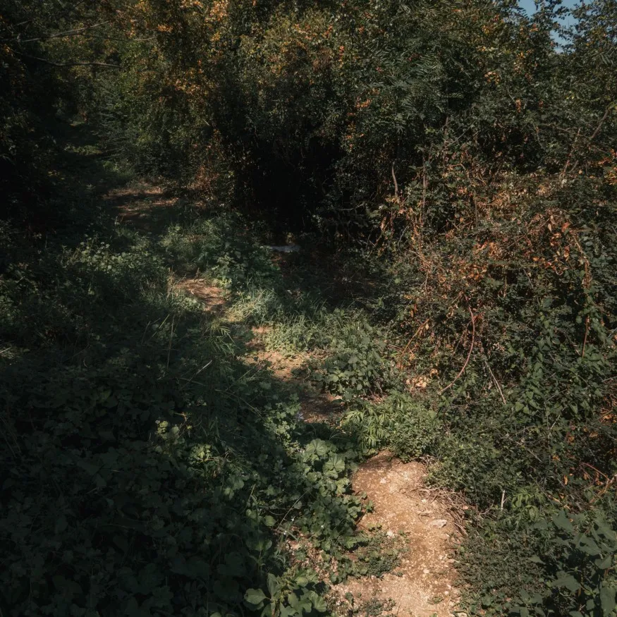
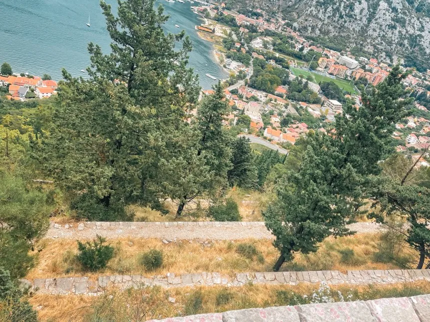
Once you’ve walked through the forested area (enjoy the few moments of shade), the switchbacks start instantly and continue for 2.6 km. Each bend offers sweeping views across the Bay of Kotor. You can see the terracotta rooftops of Kotor Old Town, the long Dobrota promenade and of course the many boats sailing along the blue waters.
Along with the views, many Hermann’s tortoise call this hill their home so keep an eye out for them either slowly climbing the trail or hiding in the grassy areas of the trails.
Although we didn’t see any ourselves, Kotor has snakes including the nose-horned viper. Be careful in areas with tall grass.
Once you have completed the switchbacks, you will come to Goran’s Farm, a large farm with pigs, horses, goats and chickens. You can actually purchase some of his fresh produce like eggs and cheese and he allows you to camp on his land – at no extra cost.
From Goran’s Farm, Fort Vrmac is on your left.
Fort Vrmac
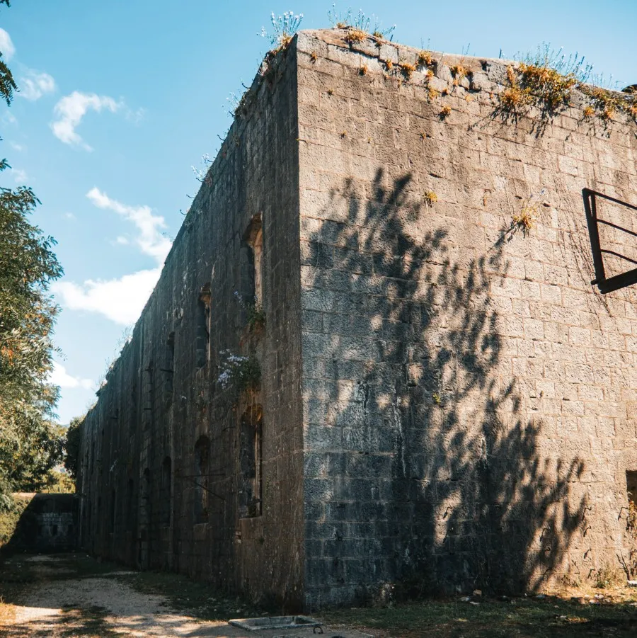
Fort Vrmac sits at the top of the Franz Joseph trail. First established in 1860, the fort was heavily bombed during WW1, with over 100 grenades fired at it by the Montenegrin army from their positions on Lovćen across the bay. What you see today is largely the rebuilt version, reconstructed between 1894 and 1897. It was part of the Boka Belt, a network of 80 fortresses built between Herceg Novi and Budva between 1838 and 1918 to defend the Austro-Hungarian naval base at Kotor, which was one of the three most important in the empire alongside Pula and Trieste.
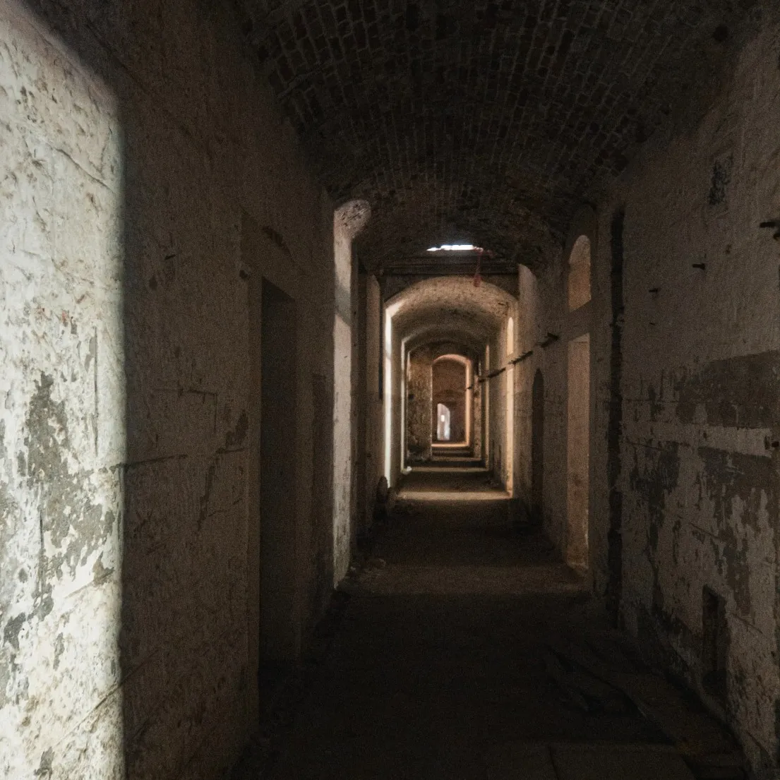
Today the remains of the fort can be explored, it’s very eerie inside, as a horror film enthusiast I didn’t like it. There is even a room full of women’s shoes, if that isn’t creepy enough – no one actually knows why or how they got there. It’s pretty dark inside so watch where you step as this is a decrepit building with parts of the floor missing.
After the fort was abandoned, a hermit monk apparently settled there and converted one of the mortar casemates into a prayer room. Frescoes are still barely visible on the walls.
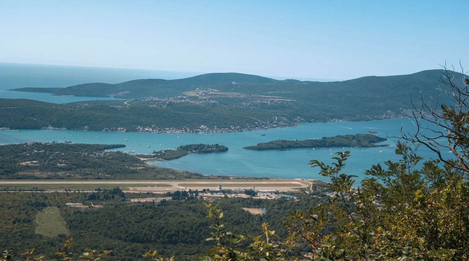
From outside the fort you can view Tivat Bay. The airport is close by meaning if you get lucky you will see a plane or two depart/arrive.
The Descent
The descent takes around an hour and follows the same switchbacks back down. Your legs will know about it.
It is not technically harder than the climb but tired legs on a rocky path require more attention than you might expect, so take it steady rather than bombing down. The views are just as good on the way back, maybe better because you are not focused on breathing.
On one of our descents we picked up a companion. A tiny kitten appeared from nowhere on the switchbacks and decided she was coming with us. She followed us all the way down to Muo, weaving between our feet on every bend. We named her Boka. She was absolutely tiny and completely unbothered by the whole situation. Honestly she was the highlight of the day and we still think about her.
If you are hiking in summer, the afternoon sun on the descent hits hard on the exposed sections. Another reason to start early so you are heading down before the heat peaks.

![]() Looking where to eat after your descent? Check out my pick of the best cafes, restaurants & bars in Kotor.
Looking where to eat after your descent? Check out my pick of the best cafes, restaurants & bars in Kotor.
The Ridge Trail: Going Beyond Fort Vrmac
Reaching Fort Vrmac is really just the beginning. The fort sits at the start of the Vrmac ridge, and from there the trail continues all the way to Donja Lastva on the other side of the peninsula. If you have the legs for it, this is where the hike gets really interesting.
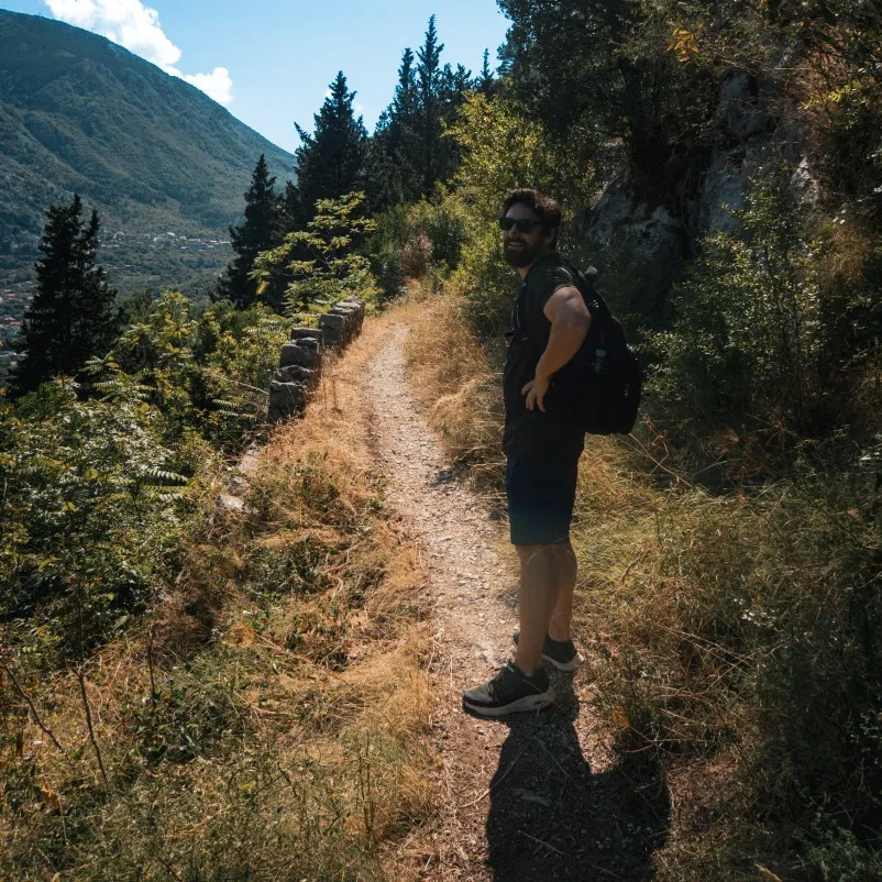
The ridge is the reason to keep going. As you walk along the top, you get views of both Kotor Bay and Tivat Bay at the same time, one on each side of you. Not many hikes in the world give you that.
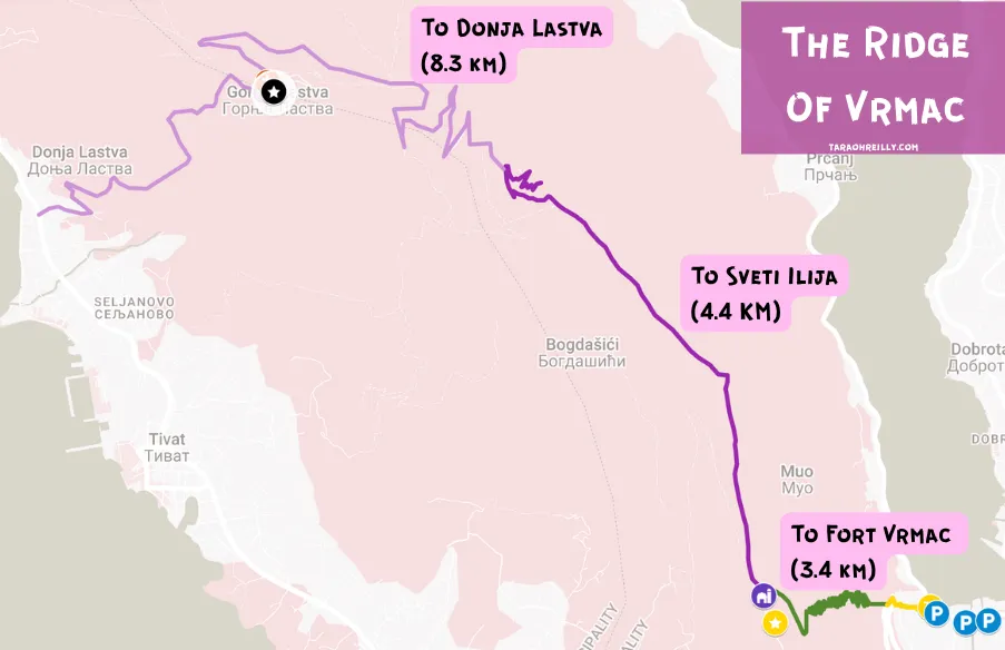
Fort Vrmac to Sveti Ilija (4.39 km one way)
This is the high point of the whole route, literally. Sveti Ilija is the highest point on the entire Vrmac peninsula at 785 metres. The trail follows the old Austro-Hungarian military road along the ridge, so it is wide and relatively easy to follow on the main path. Once you get off the main track though, it gets rocky and overgrown pretty quickly, so stick to what you can see clearly.
You can also reach this section by car if you want to skip the ascent from Muo and just walk the ridge. You can follow the AllTrails route here.
Sveti Ilija to Donja Lastva (8.23 km one way)
This is a long stretch and turns the whole thing into a serious day out. Once you leave the summit of Sveti Ilija, the character of the hike changes completely. The ridge walking is behind you and now it is all downhill, but do not let that fool you into thinking it is easy. The descent is very stony for much of the way and you really have to watch your step, especially if your legs are already tired from the climb up.
The route takes you through Gornja Lastva first, a small traditional village sitting about 300 metres above sea level on the Tivat side of the ridge. The stone alleyways feel genuinely stuck in time, and that is intentional as the locals want to preserve their architectural heritage. Church of Male Gospe which dates back to 1410, is worth a quick look. It is a good place to stop, take your boots off for five minutes, and look out over Tivat and the Luštica Peninsula before the final descent.
From Gornja Lastva the trail drops down to Donja Lastva on a paved road, which is easy walking with closer views of Tivat’s marina opening up as you descend. After a full day on the mountain, the tarmac under your feet feels like a small luxury.
One thing worth knowing before you commit to the full crossing: the descent to Donja Lastva is trickier to navigate than the Kotor side, and in the dark it becomes genuinely difficult. If you are planning to catch sunset from the summit, hike back down to Kotor rather than continuing to Donja Lastva.
The views from this side of the ridge are also different from anything you get on the way up. Instead of looking at Kotor and the inner bay, you are now looking out over Tivat, the airport runway, the Luštica peninsula, and on a clear day you can see as far as Budva to the south. It is a completely different perspective on the same mountain, which is half the reason the full crossing is worth doing if you can arrange the logistics.
By the time you reach the coast, you are looking at a big day on your feet. If you’re up to it the AllTrails route is here.
Getting back from Donja Lastva
This is the part that actually needs a solid plan.
There is a local bus called the “Kamp – Tivat – Kamp” line that runs along the old coastal road, connecting Kotor via Muo, Prčanj, Stoliv, Lepetane, Donja Lastva and Tivat. Bus tickets cost around €2 per person and the journey back is a slow, scenic crawl along a single-lane coastal road.
That said, the timetable is limited and not always reliable, so check it before you go rather than assuming there will be a bus when you need one. It should go every hour, aside from Sunday when the schedule is every 2 hours. You can find the timetable here.
Alternatively, a taxi from Donja Lastva to Kotor takes around 13 minutes and costs roughly €15-20, which starts looking very reasonable after a full day on the mountain.
Buy your bus ticket online with busticket4.me.
What To Bring
There is nowhere to buy food or water on this route except Goran’s Farm, and you cannot count on what he has available on any given day. Come prepared.
- Water: at minimum 1.5 litres per person, 2 litres in summer. There is no shade for long stretches and the ascent is relentless.
- Sun protection: sunscreen, sunglasses and a hat. The trail faces south and west and once the sun is up it finds you.
- Footwear: proper trainers at minimum, hiking boots ideally. The path is rocky and uneven, especially off the main trail. Do not attempt this in sandals.
- Snacks: bring more than you think you need. It is a longer day than it looks on paper.
- Cash: Goran’s Farm is cash only. Worth having a few euros on you for eggs or cheese, or just to say thank you for the experience of finding a working farm halfway up a mountain.
- Long trousers: not essential but worth considering. There are snakes on this trail including the nose-horned viper, particularly in areas with tall grass. We never saw one but that is not a reason to be complacent.
Should I Hike Fort Vrmac or Kotor Fortress?
Short answer: both, but if you only have time for one, do Fort Vrmac.
The Kotor Fortress trail is shorter, more manicured and costs €15 per person. It is busy, especially in summer, and it finishes at a ruined castle that is nice but well-trodden. The views of the old town from up there are genuinely brilliant, and it is a good option if you want something quick and easy to tick off.
Fort Vrmac asks a bit more of you. It is longer, the path is rougher, and you will barely see another person. In return you get a trail with actual history embedded in it, a working farm, wildlife, and a fort that feels genuinely abandoned rather than curated. The views are different too: instead of looking down at Kotor you are looking across the whole bay.
We paid for the fortress trail once and hiked Fort Vrmac four times. If your legs are up for it, the choice is obvious.
Tourist Tax: All tourists staying in Kotor for less than 30 days must pay a tourist tax within 48 hours of arrival. It costs €1 per day. The office is located here and it will be checked when you leave the country; if you don’t pay, you could be fined up to €150.
Insurance: I recommend True Traveller for EU/UK citizens and World Nomads for anyone else. Both are highly reputable and reliable travel insurers.
Mobile Data: Airalo is a super convenient eSIM that you can just download to your phone and go!
Car Rental: DiscoverCars for a large selection and competitive prices.
Best time to visit: May–June or September–October (shoulder season: warm but not heaving).
Getting there: Nearest airport is Tivat (20 mins) or Dubrovnik in Croatia (roughly 2 hours with the border crossing).
Related Posts
Is Kotor Worth Visiting
Kotor Cable Car + Alpine Coaster: Honest Review + Full Guide (2026)
Best Cafés, Restaurants & Bars in Kotor, Montenegro
Where To Stay In Kotor: Best Areas + Hotels
Ladder of Kotor vs Kotor Fortress Hike: The Complete Guide (Free & Paid)
15 Best Things To Do In Kotor